


Vegetation represents a significant threat to many critical infrastructure providers, especially when considering climate change and the increasing occurrence of extreme weather events. One fallen tree on the power line is enough to cause a significant outage and economic damage. This threat is usually mitigated with costly regular manual patrols and different preventive measures.
Your infrastructure can span hundreds of kilometers and there exists a better way to perform the inspection. We believe that we can we do this much more effectively with the help of satellite imagery and computer vision!
But first, how does it even look like from space?
You have most probably already seen examples of satellite imagery, like the ones presented below (Figure 1).
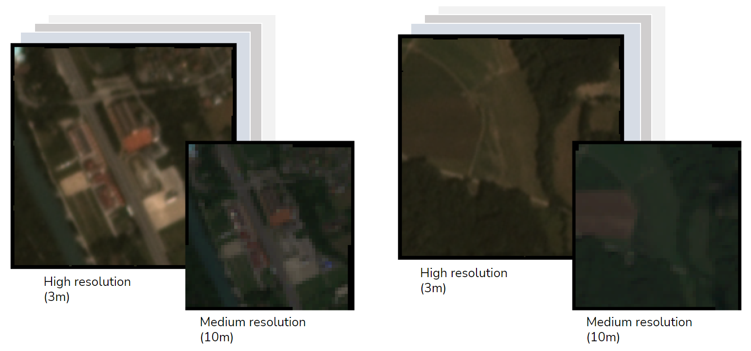
Figure 1: Example satellite imagery in high and medium resolution representing different forms of vegetation.
Satellite imagery has been popularized recently with regular usage in the media, by supporting the reporting of different world events. Unfortunately, mostly bad ones about the war and draught in the recent months. The use of satellite data is not new, but it has been long thought that this is something that is out of hands of ordinary citizens and businesses alike. The launch of Copernicus constellation of satellite by the European Space Agency (ESA) and the recent “small-sat revolution” has changed that.
The satellite imagery now comes in different shapes and forms - differing in resolution, revisit frequencies, sensors on board, and cost. In fact, visual part of satellite imagery products usually only represents a small part of the capabilities. The onboard sensors are usually able to detect wavelengths that we cannot see, but are crucial for the applications in forestry, agriculture and beyond. Another interesting fact is that the cost can be all the way down to FREE in the case of Copernicus.
Can we measure vegetation height from space?
Detecting vegetation from space seems challenging and interesting but would probably not help you much with detecting spots where there is an actual threat to your infrastructure. What about combining the vegetation location information with an accurate estimation of the vegetation height?
Seems like science fiction, but this is something that we at XLAB know how to do solely out of the satellite imagery products (including FREE), with the help of computer vision (Figure 2).
A solution like this can help you identify spots along your infrastructure that might be in danger of trees that can fall on your infrastructure, based on the proximity to your infrastructure and the height of the nearby vegetation.
You are probably asking yourself how can we do that? Stay tuned for part 2 of this blog post where we will show you how!
How can you benefit from remote infrastructure inspection?
Vegetation inspection represents just a small part of remote infrastructure inspection and the problems that you face. It also represents just a small part of what we can do with satellite imagery and computer vision! We can effectively apply our expertise and know-how to any domain and develop a solution that meets your unique business needs. Reach out to make the next big leap with AI and satellite imagery.
This work is partially funded by European Commission project SUNRISE (grant agreement number 101073821).


